
File:Europe in 1430.PNG
預覽大小:553 × 599 像素。 其他解析度:221 × 240 像素 | 600 × 650 像素。
原始檔案 (600 × 650 像素,檔案大小:69 KB,MIME 類型:image/png)
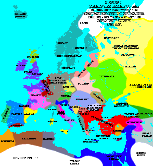
| 描述 | A map of Europe in 1430. | ||
| 來源 | [1] | ||
| 作者 | Lynn H. Nelson | ||
| 授權許可 (重用此檔案) |
|
_en.png)
.png)
.jpg)
檔案歷史
點選日期/時間以檢視該時間的檔案版本。
| 日期/時間 | 縮圖 | 尺寸 | 用戶 | 備註 | |
|---|---|---|---|---|---|
| 目前 | 2020年5月10日 (日) 20:16 | | 600 × 650(69 KB) | Santasa99 | Per John V.A. Fine: The Late Medieval Balkans: A Critical Survey from the Late Twelfth Century to the Ottoman Conquest; Chapter 9. The Balkans in the Early Fifteenth Century - Bosnia after death of Tvrtko |
| 2005年3月8日 (二) 19:30 |  | 600 × 650(44 KB) | Quadell | A map of Europe in 1430.{{PD}}Source:[http://www.ku.edu/kansas/medieval/108/lectures/]Category:Maps of EuropeCategory:Historical mapsCategory:1430 |
檔案用途
下列頁面有用到此檔案:
全域檔案使用狀況
以下其他 wiki 使用了這個檔案:
- ar.wikipedia.org 的使用狀況
- az.wikipedia.org 的使用狀況
- ba.wikipedia.org 的使用狀況
- bg.wikipedia.org 的使用狀況
- bn.wikipedia.org 的使用狀況
- bxr.wikipedia.org 的使用狀況
- ca.wikipedia.org 的使用狀況
- cs.wikipedia.org 的使用狀況
- de.wikipedia.org 的使用狀況
- el.wikipedia.org 的使用狀況
- en.wikipedia.org 的使用狀況
- en.wikibooks.org 的使用狀況
- es.wikipedia.org 的使用狀況
- fa.wikipedia.org 的使用狀況
- fi.wikipedia.org 的使用狀況
- fr.wikipedia.org 的使用狀況
- id.wikipedia.org 的使用狀況
- io.wikipedia.org 的使用狀況
- is.wikipedia.org 的使用狀況
- ka.wikipedia.org 的使用狀況
- mk.wikipedia.org 的使用狀況
- nds-nl.wikipedia.org 的使用狀況
- nl.wikipedia.org 的使用狀況
- nn.wikipedia.org 的使用狀況
- no.wikipedia.org 的使用狀況
- pnb.wikipedia.org 的使用狀況
- pt.wikipedia.org 的使用狀況
- ru.wikipedia.org 的使用狀況
- sa.wikipedia.org 的使用狀況
- scn.wikipedia.org 的使用狀況
- sh.wikipedia.org 的使用狀況
- simple.wikipedia.org 的使用狀況
- skr.wikipedia.org 的使用狀況
- sk.wikipedia.org 的使用狀況
檢視此檔案的更多全域使用狀況。